GPS Soil Sampling
DJL Agriculture has taken GPS soil sampling & testing to the next level. Driving farming forwards!
Why use the DJL GPS soil sampling service?
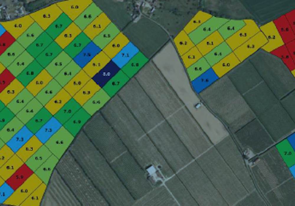
Colour coded Nutrient Maps are created, clearly highlighting any variation in nutrients.
All major elements are portrayed on one sheet of paper, easing quick evaluation.
The Nutrient Maps provide enough information to produce variable fertiliser recommendations for crops in arable and grassland situations.
Click Play to see special offer
Soil Sampling Service Nutrient Maps
Soil sampling service nutrient maps can be easily imported into Gatekeeper to enable other information such as yield maps to be viewed making data analysis that much easier. Though the standard analysis is P,K,Mg and pH, any element can be analysed upon request, or alternatively a Broad Spectrum analysis package which is becoming more popular.
FACTS Qualified Soil Health Consultants
Fertiliser recommendations are made up by our soil health consultants who are FACTS qualified personnel for each field. The fertiliser application maps can be created for any controller and are easily transferred to GPS devices for vari-rate spreading.

